Back to Courses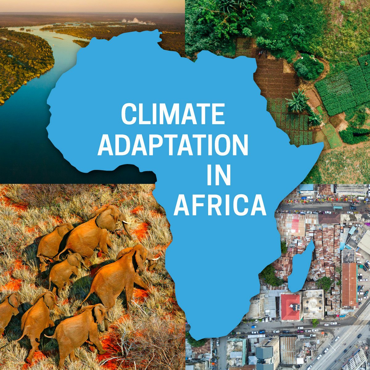


Environmental Science And Sustainability Courses - Page 6
Showing results 51-60 of 151
Climate Adaptation in Africa
This course explores why climate change adaptation is important in the African context. Africa is considered one to be one of the most vulnerable regions to climate change. Historically, climate-related hazards such as drought, flooding, pest and disease outbreaks, coastal storms and heat waves have had devastating impacts on people and the environment in which they live. Often the damage knocks back progress that has been made in social and economic development, slowing down the achievement of development goals. Climate models suggest that many of these climatic hazards will intensify as the global climate warms. Building resilience to climate risks, through adaptation, is critically important for future development in Africa.
The course will examine adaptation in theory and in practice, through a focus on four sectors that are critically important for climate resilient development in Africa: Water Security, Agriculture and Food Security, Ecosystems and Ecosystem Services and Resilient Cities.
Sustainable Neighborhoods
This course will provide students with an introduction to tools and concepts for a better understanding of the importance of the neighborhood as part of a sustainable city. This will include a careful look at the natural context of successful neighborhoods. An evaluation of important components and structure that create a sustainable neighborhood. Complete neighborhoods can provide their residents with pedestrian access to schools, daycare, recreational centers, and a variety of open spaces, as well as opportunities for food production. These and other aspects of sustainable neighborhoods will be carefully evaluated in this course. There will also be case studies of neighborhood development projects in Houston, TX, San Antonio, TX, and Chattanooga, TN. And lastly, the course will review the importance of zoning on sustainable neighborhoods with a particular focus on form-based zoning.
By the end of this course, you will be able to:
• Construct general plans for urban parks and natural corridors for achieving natural context neighborhoods.
• Analyze how neighborhood schools, support services and civic sites contribute to neighborhood livability and sustainability.
• Examine how local open space and housing density can be balanced as neighborhood components to achieve sustainable communities.
• Evaluate the aspects of neighborhood structure that include packet parks, open-space configurations, and transit orientation in communities.
• Apply lessons learned from the evaluation of three case studies at the Buffalo Bayou project in Houston, Texas, the Pearl District project in San Antonio Texas, and 21st century waterfront project in Chattanooga Tennessee.
• Explain the importance of zoning for sustainable neighborhoods with a particular focus on form-based zoning.
Example backgrounds that would be helpful for students to succeed in this course:
- To have a general understanding of how public/private projects are planned and implemented
- Have a strong interest or experience in planning and developing regional sustainable development plans
- Familiar with how government organizations function in the areas of transportation planning and project development
- Served as a volunteer committee member or leader on regional transportation projects and/or regional policy development initiatives
- Have a background and interest in environmental protection plans and projects
- A general knowledge of regional transportation project planning and implementation
- General knowledge or experience in public participation in governmental policy development
- A strong interest and/or experience in improving the urban environment for the benefit of its citizens
- Have a general knowledge of legal and policy issues involved in sustainable development
- Have experience or general knowledge of social equity issues
Renewable Power and Electricity Systems
The energy revolution in underway. Renewable energy is growing at an astounding pace - notably in electricity. Wind turbines and solar photovoltaic (PV) systems account for most new power plants built worldwide, and are essential to building a low-carbon and sustainable energy future. As a result, there are countless new opportunities in renewable electricity.
This course provides a solid grounding in the basics of renewable electricity. We'll start with how electricity is measured, how electricity systems operate, and how renewable technologies like wind turbines and solar PV work. We'll then cover technical and market fundamentals: how and why renewables are driving change in electricity systems worldwide, how electricity systems are changing to accommodate all these new renewables, and what that all means for those seeking to understand and participate in the global transformation of electricity systems. This global transformation is just beginning; with knowledge gained from this course you'll be ready to jump on board.
Course logo image credit: "Wind Turbine" icon courtesy of Vectors Point from the Noun Project.
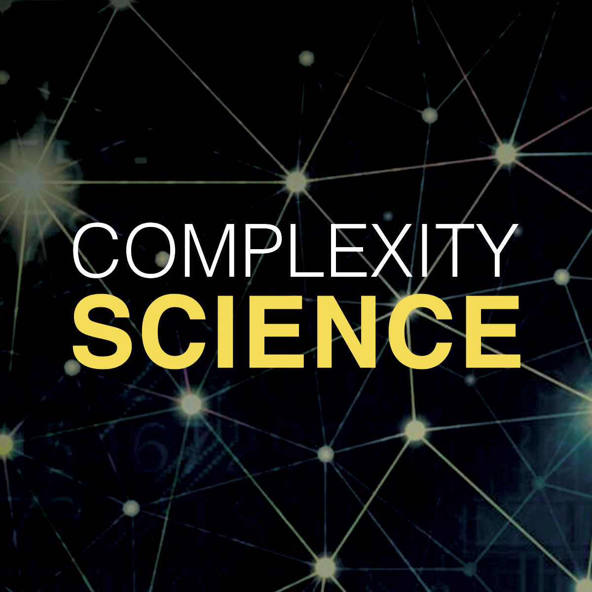
Introduction to Complexity Science
This course explores the features of complexity science. Our world is connected by an abundance of complex systems. Across all levels of organizations from physical, biological world to the social world, we may think of the connectivity between individual elements and how they interact and influence each other. For example, how humans transmit pandemics within a group, how cars interact in the traffic system and how networks connect in governmental organizations. Although these systems are diverse and different, they have surprisingly huge features in common.
In the past several decades, the study of complexity science has been increasing. It is widely acknowledged that an innovative, integrated and analytical way of thinking is essential for understanding the complex issues in the human societies. In this course, we will aim to give everyone a comprehensive introduction of the complex systems, to talk about the resilience, robustness and sustainability of the systems and to learn basic mathematical methods for complex system analysis, for example regime shifts and tipping points, the agent-based modelling, the dynamic and network theories. Most importantly, we will implement the theories into practical applications of cities and health to help students gain practice in complex systems way of thinking.
Transportation, Sustainable Buildings, Green Construction
This course will include the evaluation of best practices in parking strategies for sustainable cities. Some of the examples include downtown parking policy, understanding the high cost of free parking, the development of parking sheds, managing neighborhood parking, hiding parking lots and other parking strategies and practices. There will also be a case study of the Victoria Canada parking management approach that investigates problems with current work on parking planning and discusses the cost of parking facilities and potential savings from improved management. There will also be an introduction to the use of form-based codes for application to sustainable cities. A variety of building forms such as mid-rise and high-rise buildings, apartment houses, live/work buildings, single-family homes, and row houses will be assessed. A particular emphasis will be on vacant property strategies for equitable and healthy communities. Vacant property strategies for reclamation will be evaluated with an analysis of the revitalization cycle. Green building construction principles will be evaluated in consideration for natural light and ventilation, solar orientation, use of sustainable building materials, energy efficient design and on-site energy generation as well as other considerations. Building architectural design will leverage climate, construction materials, and the culture and history of the area. Architecture choices should have a consistent appearance within the community and provide residential privacy. Other considerations include protection and preservation of historic buildings, use of universal design concepts, careful placement of civic buildings and the appropriate use of subsidized housing.
By the end of this course, you will be able to:
1. Survey and evaluate a variety of parking policies that support sustainable cities and environmental quality.
2. Compare different parking options such as parking sheds, neighborhood parking, parking lot access, permeable parking spaces, and a variety of ways to hide parking lots.
3. Describe the approach that the state of Minnesota used in developing a greenhouse gas reduction plan for their transportation sector.
4. Examine issues of implementing climate – friendly transportation pricing and the concept of “fix it first” transportation policy.
5. Evaluate the concept of form-based codes and their benefits for creating sustainable cities.
6. Assess smart green construction practices such as use of sustainable building materials, on site energy generation, proper solar orientation, and the use of green building standards.
Target Audience
• Government Officials involved planning, designing, monitoring, enforcement, and assessment of sustainable project developments at the local, state, and federal level.
• Private sector companies in the transportation and municipal design and construction business
• Architects interested in advancing sustainable concepts for cities and communities
• Foundations, associations, and other NGOs that support smart growth strategies
• Academic faculty and students studying and researching community sustainability and resilience
• Private citizens interested in improving their communities and living conditions
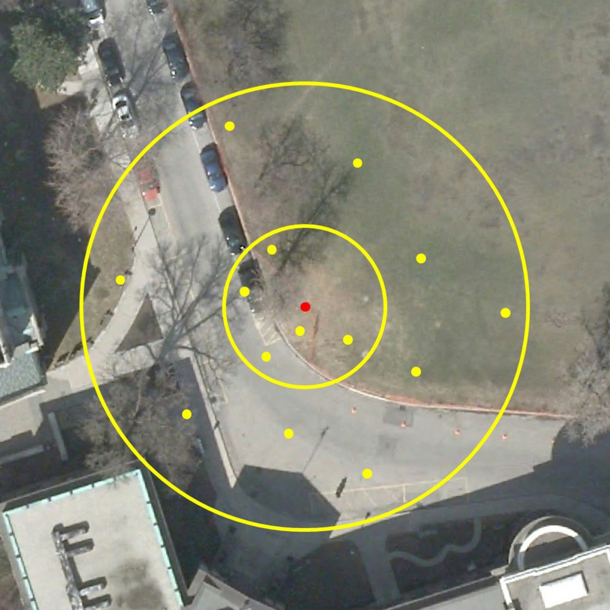
Geographical Information Systems - Part 1
This course is organized into two parts presenting the theoretical and practical foundations of geographic information systems (GIS).
- Together theses courses constitute an introduction to GIS and require no prior knowledge.
- By following this introduction to GIS you will quickly acquire the basic knowledge required to create spatial databases and produce high-quality maps and cartographic representations.
- This is a practical course and is based on free, open-source software, including QGIS.
If you study or work in the fields of land management or the analysis of geographically distributed objects such as land use planning, biology, public health, ecology, or energy, then this course is for you!
In this first part of the course, we will focus on the digitization and the storage of geodata. In particular, you will learn:
- To characterize spatial objects and/or phenomena (territory modeling) with respect to their position in space (through coordinate systems, projections, and spatial relationships) and according to their intrinsic nature (object/vector mode vs. Image/raster mode);
- About the different means used to acquire spatial data; including direct measurement, georeferencing images, digitization, existing data source, etc.);
- About the different ways in which geodata can be stored - notably, files and relational databases;
- How to use data modeling tools to describe and create a spatial database;
- To query and analyze data using SQL, a common data manipulation language.
The second part of this course will focus on methods of spatial analysis and geodata representation. In this section, you will learn:
- How to describe and quantify the spatial properties of discrete variables, for example through spatial autocorrelation;
- To work with continuous variables. In particular, we will look at sampling strategies, how to construct contour lines and isovalue curves, and we will explore different interpolation methods;
- To use digital elevation models and create their derivative products (i.e. slope, orientation);
- How to evaluate the interaction between different types of geodata through overlay and interaction techniques;
- How to create effective maps based around the rules of graphic semiology;
- Finally, we will also explore other, increasingly common, forms of spatial representation such as interactive web-mapping and 3D representations.
You can find an interactive forum for course participants on our Facebook page: https://www.facebook.com/moocsig
GIS Data Acquisition and Map Design
In this course, you will learn how to find GIS data for your own projects, and how to create a well-designed map that effectively communicates your message. The first section focuses on the basic building blocks of GIS data, so that you know what types of GIS files exist, and the implications of choosing one type over another. Next, we'll discuss metadata (which is information about a data set) so you know how to evaluate a data set before you decide to use it, as well as preparing data by merging and clipping files as needed. We'll then talk about how to take non-GIS data, such as a list of addresses, and convert it into "mappable" data using geocoding. Finally, you'll learn about how to take data that you have found and design a map using cartographic principles. In the course project, you will find your own data and create your own quantitative map.
Note: software is not provided for this course.
Sustainable Regional Principles, Planning and Transportation
This course will provide students with an introduction to sustainable regional principles, regional planning concepts and evaluate regional transportation system issues. This will be achieved through dynamic video lectures, practical case studies and the evaluation of practices for success. These will include discussions of the importance of the regional plan, how to engage community involvement, the importance of understanding a development transect and others. Strategies for growth priorities, along with consideration of available housing and food security will also be addressed. The concepts of providing a rural preserve and a rural reserve will be evaluated and mapping of key aspects of the region, such as neighborhoods and districts will be explained. Evaluation of regional transportation systems will be addressed including multi-mobile balance and building choices into the transportation system modes. The considerations for including a regional railway system along with accommodating user mobility and accessibility will be explored.
By the end of this course, you will be able to:
- Formulate the relationship between regional principles, smart growth, and sustainability.
- Evaluate growth priorities, community involvement and scale of governance to achieve sustainable smart growth.
- Evaluate and explain regional mapping of rural preserves, rural reserves, neighborhoods, and districts as important tools in regional smart growth planning.
- Describe the implications of mapping corridors and regional centers to the overall smart growth planning at the regional level.
This course is for :
- Government Officials involved planning, designing, monitoring, enforcement, and assessment of sustainable project developments at the local, state, and federal level.
- Private sector companies in the transportation and municipal design and construction business.
- Architects interested in advancing sustainable concepts for cities and communities.
- Foundations, associations, and other NGOs that support smart growth strategies.
- Academic faculty and students studying and researching community sustainability and resilience.
- Private citizens interested in improving their communities and living conditions.
The following list identifies background knowledge that will help you succeed in this course.
- helpful to have a general understanding of how public/private projects are planned and implemented
- have a strong interest or experience in planning and developing regional sustainable development plans
- familiar with how government organizations function in the areas of transportation planning and project development
- served as a volunteer committee member or leader on regional transportation projects and/or regional policy development initiatives
- have a background and interest in environmental protection plans and projects
- a general knowledge of regional transportation project planning and implementation
- general knowledge or experience in public participation in governmental policy development
- a strong interest and/or experience in improving the urban environment for the benefit of its citizens
- have a general knowledge of legal and policy issues involved in sustainable development
- have experience or general knowledge of social equity issues
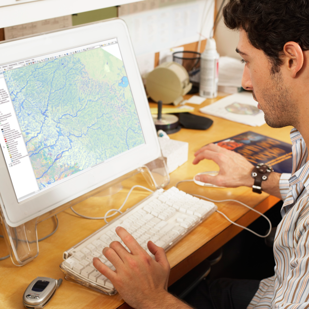
Fundamentals of GIS
Explore the world of spatial analysis and cartography with geographic information systems (GIS). In this class you will learn the basics of the industry’s leading software tool, ArcGIS, during four week-long modules:
Week 1: Learn how GIS grew from paper maps to the globally integrated electronic software packages of today. You will install ArcGIS on your computer and learn how to use online help to answer technical questions.
Week 2: Open up ArcGIS and explore data using ArcMap. Learn the foundational concepts of GIS, how to analyze data, and make your first map.
Week 3: Make your own maps! Symbolize data and create an eye-catching final product.
Week 4: Share your data and maps and learn to store and organize your data.
Take Fundamentals of GIS as a standalone course or as part of the Geographic Information Systems (GIS) Specialization. By completing the first class in the Specialization you will gain the skills needed to succeed in the full program.
Students who need an ArcGIS license will receive a non-commercial, 1 year student license for participation in this course and specialization.
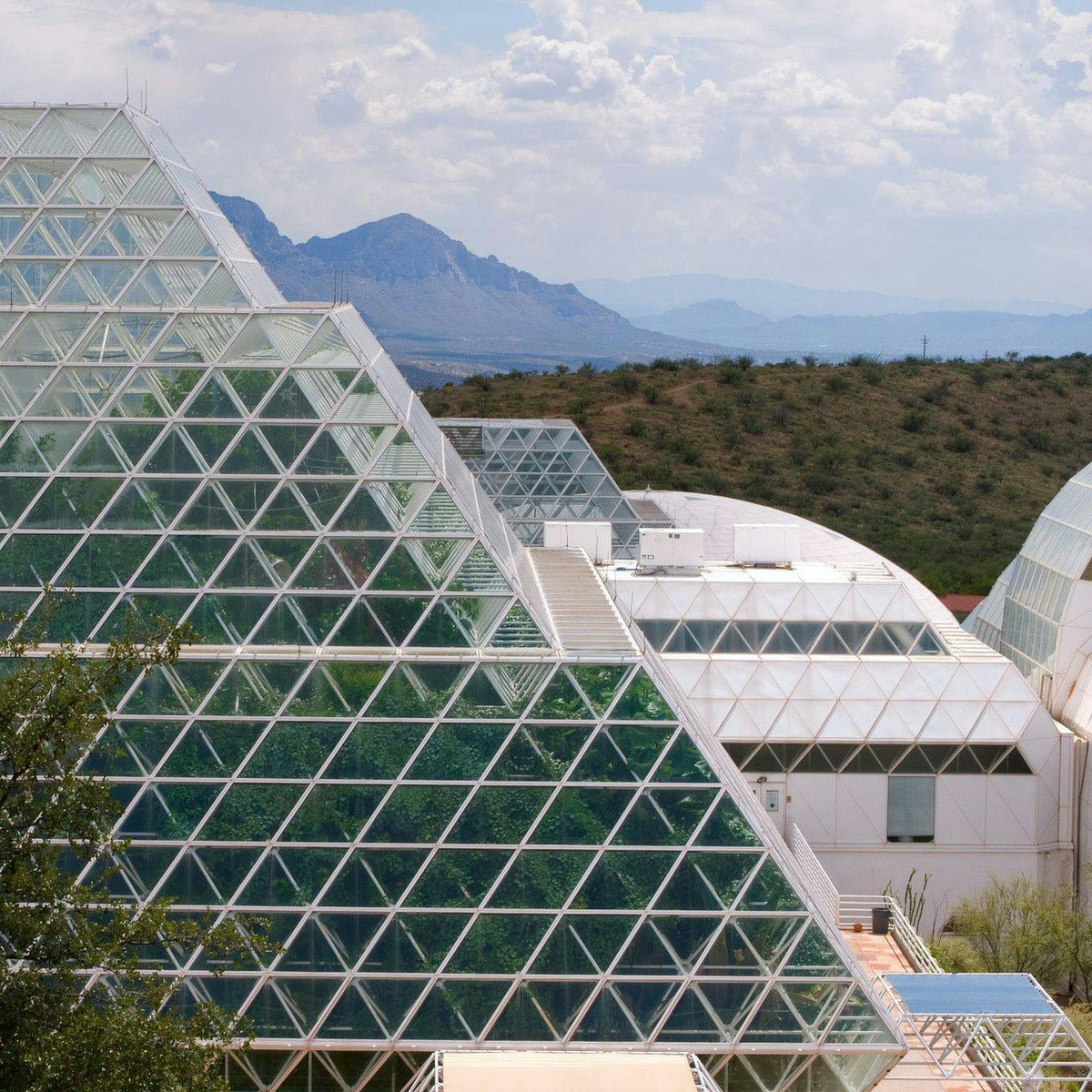
Biosphere 2 Science for the Future of Our Planet
Are you ready to take an incredible journey around Planet Earth and beyond? In this course, you will delve into a world of innovative science and learn from a team of Biosphere 2 and University of Arizona researchers. From plants and soils, to oceans and rainforests, the Moon, Mars, and more, this course is an exciting opportunity for anyone interested in science and Earth stewardship.
Learn how a unique research station in the Arizona desert is used to investigate big ideas, such as how Earth systems interact, the effects of climate change, and what our future holds. Go back in time thousands of years with information locked in ancient trees, and travel into an imagined future where humans become Martians. Collect and analyze your own scientific data, discuss big questions with participants from around the world, and gain novel insights and understanding about our wonderfully unique planet.
Popular Internships and Jobs by Categories
Find Jobs & Internships
Browse


© 2024 BoostGrad | All rights reserved